Salmon River Sections Explained: Middle Fork, Main & Lower
The Salmon River, Explained: Middle Fork, Main, and Lower Sections of Idaho’s Wild & Scenic River
There are few places left in America where a river runs wild and free for more than 400 miles unbroken — where mountains rise undeveloped, clear water rushes through untouched canyons, and the only sounds are wind, water, and wildlife. Idaho’s Salmon River is one of them.
But “the Salmon River” isn’t one trip. It’s a river system, with three iconic free-flowing sections that each deliver a completely different experience: the Middle Fork, the Main Salmon, and the Lower Salmon. Permits, character, season, and feel all change depending on which section you’re on.
If you’ve been researching Idaho rafting and feel a little lost in the section names, this guide is the orientation. We’ll walk through what each section is, who runs it, what makes it special, and how to figure out which one belongs on your shortlist.
The Salmon River system, at a glance
The Salmon River is the longest free-flowing river contained entirely within a single state in the lower 48. From its headwaters near Stanley, Idaho, it runs more than 400 miles before joining the Snake River. Along the way, it carves the deepest river gorge in North America after Hells Canyon and passes through the heart of the Frank Church – River of No Return Wilderness, the largest contiguous wilderness in the lower 48.
The Salmon River is one of the original eight rivers protected by the 1968 Wild & Scenic Rivers Act.
Middle Fork flows free. This remains true down through the Main and Lower sections of the Salmon River.
That continuous wild, undammed character is the thread that connects all three sections, even though each one feels like its own world.
Three sections most rafters talk about:
- The Middle Fork of the Salmon — a 100-mile alpine wilderness river, lottery-permit only, the bucket-list trip
- The Main Salmon (the “River of No Return”) — the section just below where the Middle Fork joins, also lottery-permit only, big-water canyon classic
- The Lower Salmon (the “Canyons”) — the final 53-mile run before the Salmon meets the Snake, more accessible permits, sandy beaches, swim-friendly water
Plus two waterways often confused with the Salmon system: the
South Fork of the Salmon (a remote technical run, not a typical multi-day trip) and the
Snake River through Hells Canyon, which the Salmon eventually joins.
The Middle Fork of the Salmon
What it is
A 104-mile river that begins at the confluence of Bear Valley and Marsh Creeks near Stanley, Idaho, and flows north through the center of the Frank Church Wilderness until it joins the Main Salmon. It drops roughly 2,700 feet over its length — steep, technical, and remote.
What it’s like
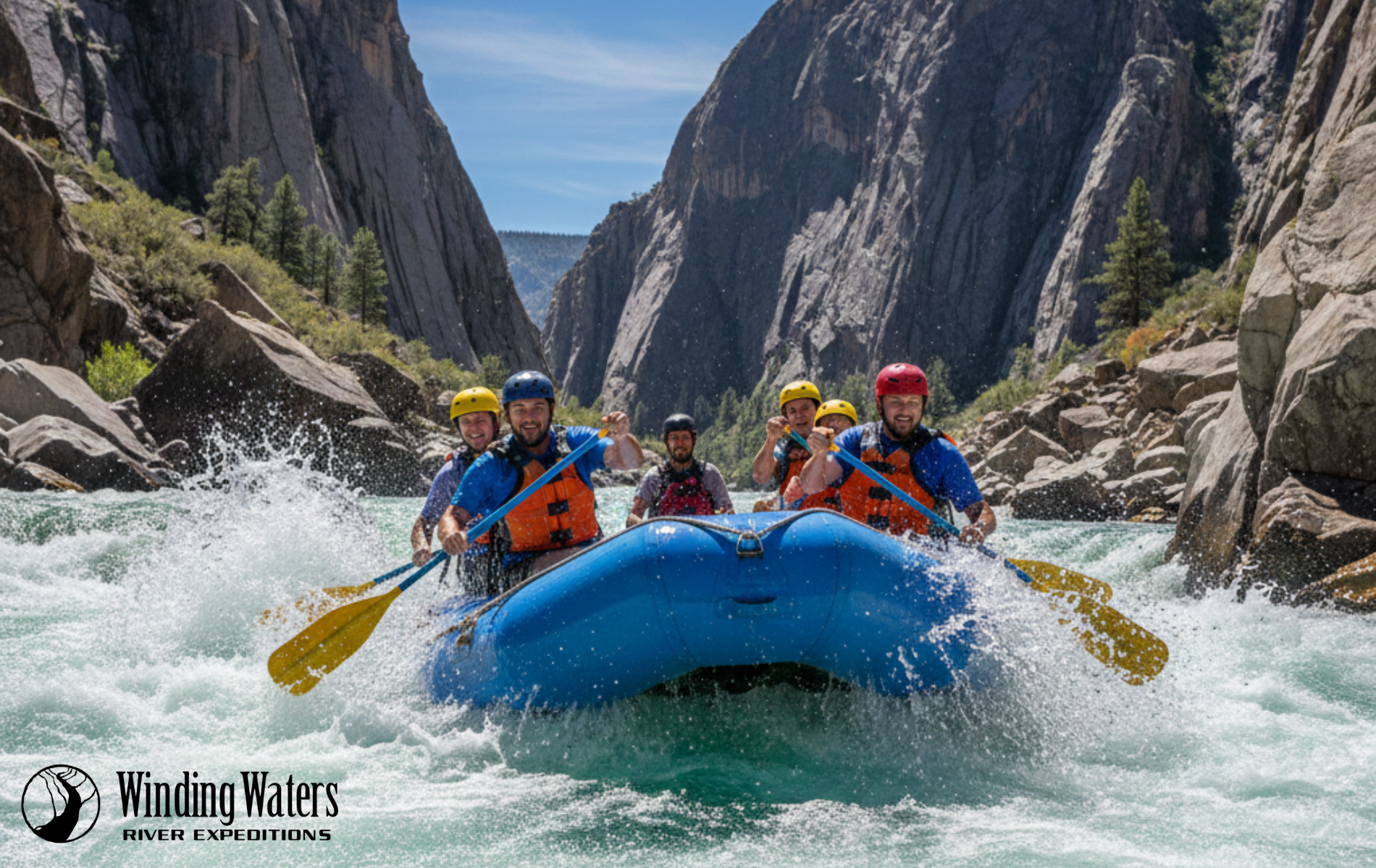
The Middle Fork is widely regarded as one of the best multi-day wilderness rafting trips in the country. The first 25 miles drop fast (around 40 feet per mile of gradient), with continuous Class III–IV whitewater. As you move downstream, the canyon opens, the rapids spread out, and natural hot springs, side-canyon hikes, and pictographs become the daily rhythm. Most trips run 5–6 days.
Why people call it the Crown Jewel of Idaho Rivers
The Middle Fork’s reputation isn’t built on whitewater alone. Between rapids, you’ll find natural hot springs tucked into the canyon walls, side-trail hikes to waterfalls, and sandy beach camps under the Milky Way. Each evening feels like a retreat into wilderness — no roads, no service, just the river and the campfire. Long before rafters arrived, the Shoshone and Sheepeater tribes lived along this river, fishing its waters and carving pictographs into the canyon walls. Later, homesteaders tried to tame the canyon — their old cabins and artifacts still whisper stories of endurance along the riverbanks. In a system of remarkable rivers, this is the one most often called Idaho’s Crown Jewel.
Permits
The Middle Fork is lottery-permit only during the high-use season (roughly mid-May through early September). The 2025 lottery drew nearly 20,000 applicants for 353 permits — under a 2% chance of winning. That’s why most travelers who want to raft the Middle Fork book through one of the dozen-or-so authorized commercial outfitters who hold their own permits.
Who runs it
The Middle Fork is operated by a permitted group of outfitters based mostly in Stanley and Salmon, Idaho. Winding Waters River Expeditions does not run trips on the Middle Fork — our permits and operating area are downstream, on the Lower Salmon. If the Middle Fork is the trip you want, look for an outfitter that holds a Middle Fork permit and operates out of Stanley or Salmon, ID.

The Main Salmon — “The River of No Return”
What it is
The Main Salmon picks up where the Middle Fork leaves off. From the confluence near Corn Creek, the Main runs about 80 miles through equally remote wilderness canyon before reaching Riggins, Idaho. It earned its nickname in the early 1800s, when explorers found the canyon walls so steep that traveling back upstream was nearly impossible.
What it’s like
Compared to the Middle Fork, the Main has bigger pool-drop rapids, warmer water, and longer beaches for camping. Most multi-day trips run 5–6 days. The whitewater is largely Class III with a few Class IV features. The wilderness setting is just as remote as the Middle Fork, but the river itself is larger and friendlier — many guides describe it as the “more relaxing” of the two upper sections.
Permits
The Main Salmon is also
lottery-permit only during the controlled-use season. Like the Middle Fork, this is a trip most people experience through a commercial outfitter who holds permits.
Who runs it
A separate set of permitted commercial outfitters operates on the Main. Many run both the Middle Fork and the Main as a connected program. Winding Waters does not hold a Main Salmon permit either — our home stretch is the section below.
The Lower Salmon — the “Canyons” of the Salmon
What it is
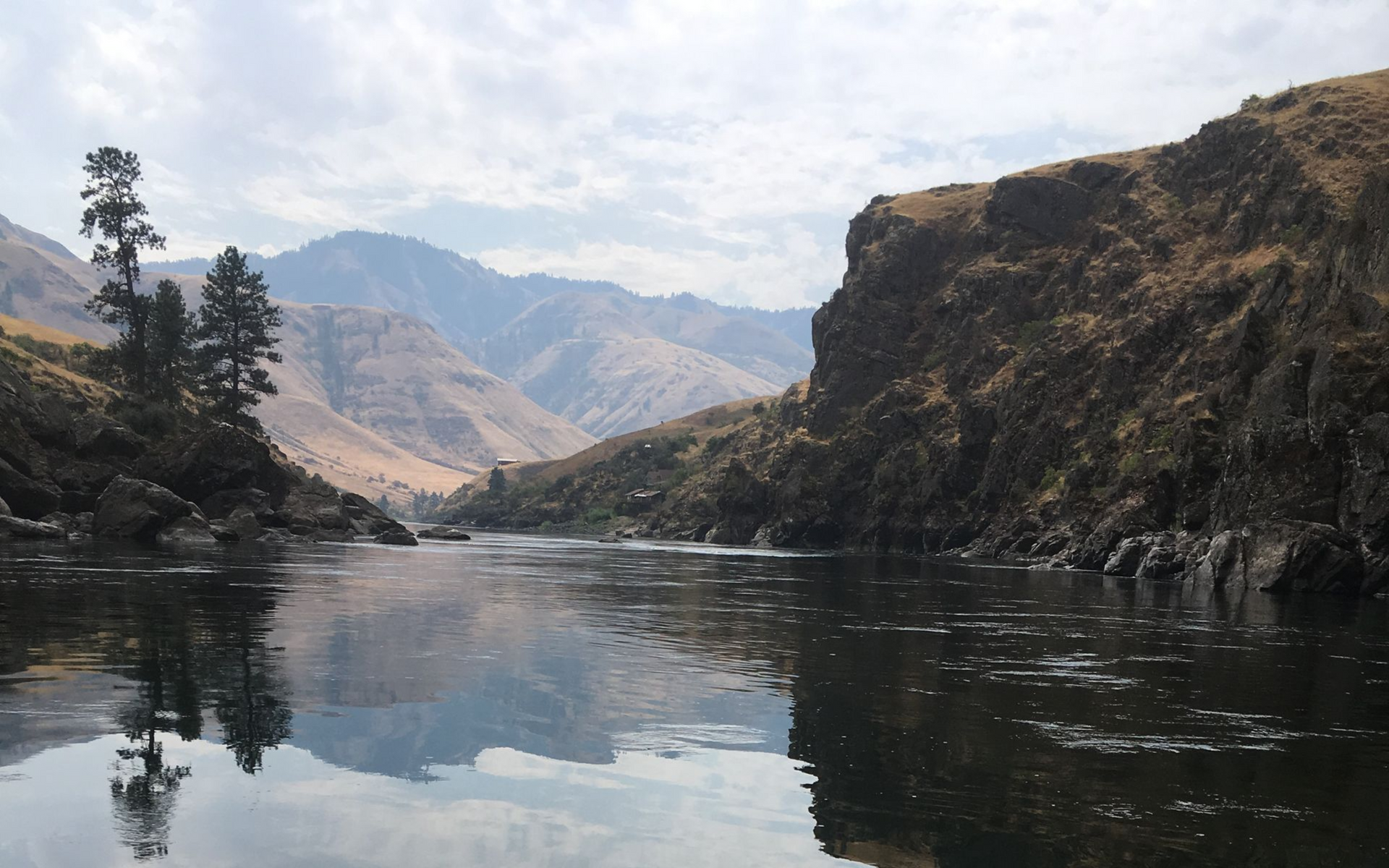
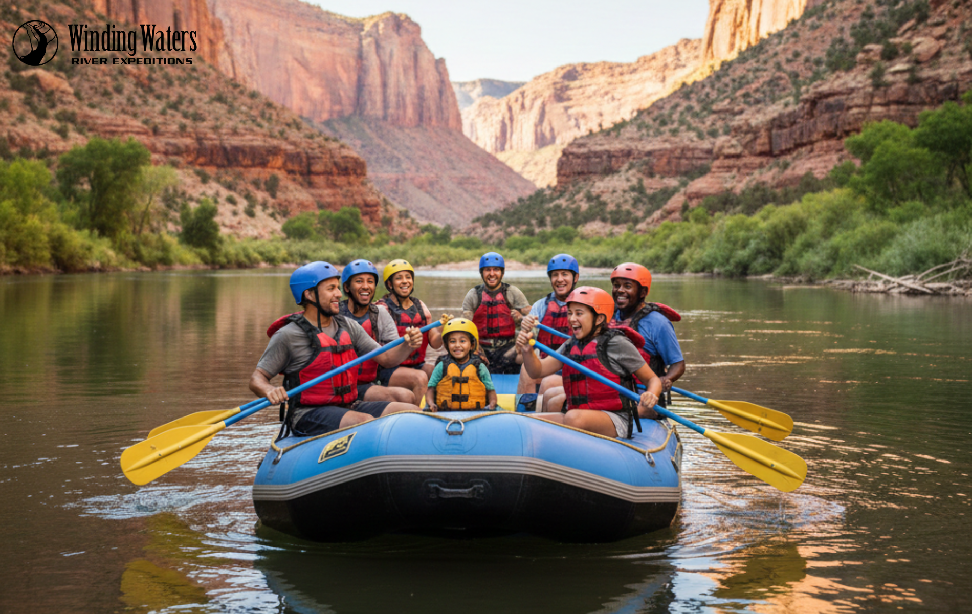
The Lower Salmon is the final 53 miles of the Salmon River before it joins the Snake. After the Main Salmon ends near Riggins, the Lower Salmon carves through four distinct canyons — Green, Cougar, Snow Hole, and Blue — and finally meets the Snake at the Idaho-Oregon-Washington border. This is where Winding Waters operates.
What it’s like
The Lower Salmon is the most accessible section of the Salmon system, in every sense. The water is undammed and snowmelt-fed, but by the time it reaches our stretch, it’s warmed to comfortable swimming temperature. The rapids are largely Class III, big enough to be exciting but approachable for first-time multi-day rafters and families. The canyons are wide and open, with massive sand beaches that make camping feel more like a beach vacation than a backcountry ordeal. Trip lengths typically run 4, 5, or 6 days.
Permits
Permits for the Lower Salmon are managed differently from the Middle Fork and Main — there’s no lottery, and commercial outfitters operate on regular use permits. That’s part of why the Lower Salmon is the most realistic Salmon River trip to plan around your own calendar instead of a once-in-five-years lottery hit.
Who runs it
A handful of permitted outfitters guide the Lower Salmon. Winding Waters is one of them. We’re a family-owned operation based in Joseph, Oregon, and the Lower Salmon is one of our flagship rivers. Trips are available in 4-day, 5-day, and 6-day formats.
Side-by-side: which section is right for you?
| Feature | Middle Fork | Main Salmon | Lower Salmon |
|---|---|---|---|
| Length | ~100 miles | ~80 miles | ~53 miles |
| Whitewater | Class III–IV (continuous up top) | Class III, occasional IV (pool-drop) | Class III, swim-friendly |
| Trip length | 5–6 days | 5–6 days | 4, 5, or 6 days |
| Season | Mid-May – early Sept | Mid-June – early Sept | Late June – mid-Sept |
| Permits | Lottery-only (~2% odds) | Lottery-only | Outfitter use permits |
| Water character | Cold, alpine, tight | Big-water, warmer | Warm, sandy beaches |
| Wilderness setting | Frank Church, deep | Frank Church, deep | Open canyon, accessible |
| Best for | Bucket-list rafters who want classic wilderness whitewater | Repeat rafters who want big water and long beaches | First-time multi-day rafters and families |
| WWRE runs it? | No | No | Yes |
A note on Frank Church and the Wild & Scenic legacy
The continuous wildness of the Salmon system isn’t an accident — it’s the result of decades of advocacy, much of it led by Idaho Senator Frank Church. The Wild & Scenic Rivers Act of 1968 protected the Middle Fork as one of the original eight. Later, the
River of No Return Wilderness was renamed in his honor — more than 2.3 million acres of pristine land where elk, bighorn sheep, black bears, and even wolves still roam freely.
Frank Church was also instrumental in creating the Hells Canyon National Recreation Area, which protects the deepest river gorge in North America directly to the west. The same hand shaped both river systems Winding Waters guides today. Floating either is a glimpse into what America used to be.
How to choose
If you have the patience for the Middle Fork or Main lottery — or the budget to book years out with a permitted commercial outfitter — those trips are extraordinary, and worth the wait. They’re also the trips most often featured in magazine spreads, which is why “Salmon River” so often gets shorthand for “Middle Fork.”
If you want to raft the Salmon system this year, want to bring family or first-time rafters, or want a trip that pairs sandy-beach camping with real Class III whitewater in a wild canyon — the Lower Salmon is the answer. It’s the section that doesn’t require lottery luck, and it’s the section we know best.
Or if you’re ready to look at trip dates, our
4-,
5-, and
6-day Lower Salmon adventures are open for booking now.